
Every piece is a place.

Relief-map puzzles of real places. Every piece is a county or a state, with the real rivers and the real height of the mountains, cut from the public elevation data and printed one set at a time in Fort Collins, Colorado.

The puzzles

One of each is built and on the shelf. After that, every set is printed to order, about 1–2 weeks for Colorado, 2–3 weeks for the United States. For Christmas delivery in the US, order the United States by December 1 and Colorado by December 8.

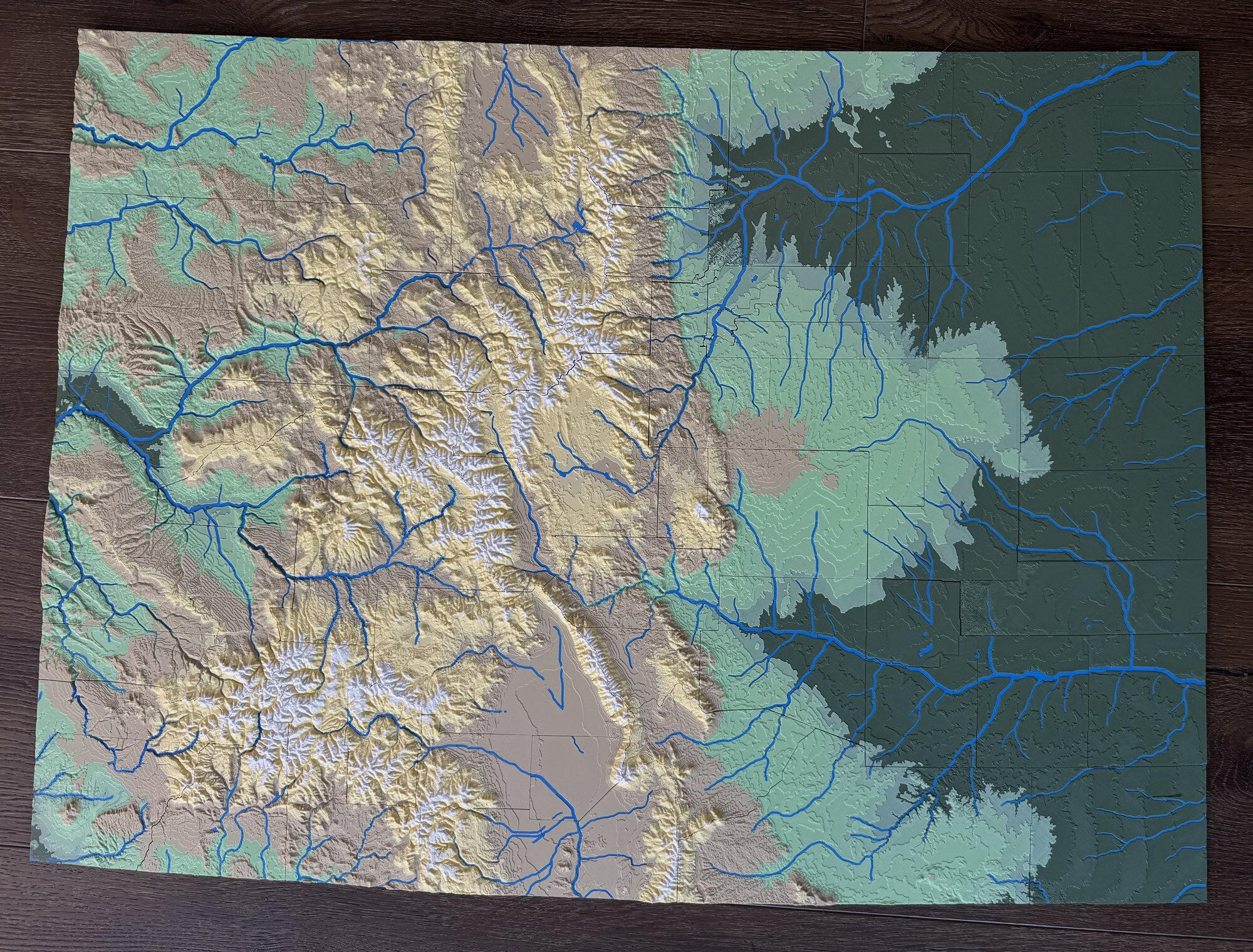
Colorado by county: pick up the county you live in.

Colorado by county, assembled: the Rockies in tan, yellow and white, the plains in green, rivers in blue

If it's Larimer, the Poudre comes down out of the canyon right where it does. If it's Summit, the piece is a bowl of yellow and white with Dillon Reservoir in the middle, and you can see why it feels like somewhere else up there. All 64 counties, with some 300 rivers and creeks inlaid in blue. A river runs straight across a county line and tells you where the next piece goes.

64 pieces · 30 × 21¾ in assembled · 1 in ≈ 13 miles · Mount Elbert stands 0.4 in above the plains · USGS elevation and hydrography, Census county lines · clear latching case with a printed key

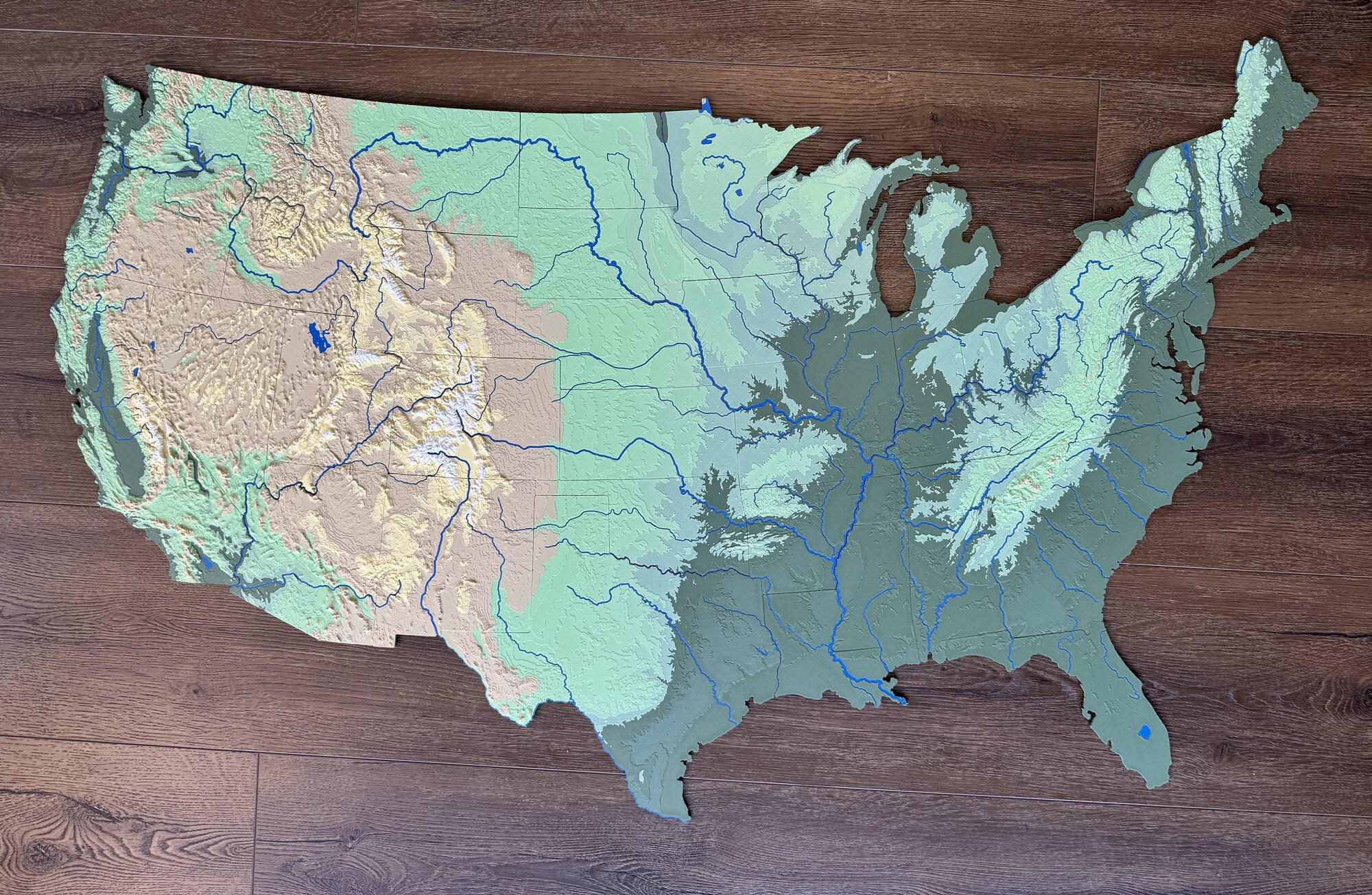
The United States by state: find the state you're from and the state you're in.

The United States by state, assembled, four feet wide

The borders that wander are rivers: the Ohio, the Mississippi, the Missouri, the Rio Grande. They are inlaid in blue, so you can trace the water from your hometown to the sea. A four-foot map of the lower 48, state by state, in real relief: Colorado is the tallest piece and Florida the flattest, and the Appalachians run as one ridge from Alabama to Maine.

50 pieces · 48 × 30 in assembled · 1 in ≈ 60 miles · 105 rivers and 24 lakes · USGS elevation, Census state lines, Natural Earth water · clear latching case with a printed key

Every piece is someone's place.

I started making these for my own table. The first one was Kansas, where I grew up: my wife and I finished it late on a Friday and spent the next hour working out why so many of the county lines have notches in them. (The old survey grid. It's on the card in the box.) Then the United States, which my daughter and I built on the floor. She asked why some borders are squiggly, and the answer is rivers. Then Colorado, where we live now, which she can point at: this is our house, this is Summit County, this is why it feels like somewhere else up there.

Every piece is a county, a state or a neighborhood, cut from one relief model of the whole. The heights are real, so the Front Range stands off the plains exactly where it does out the window, and a river runs straight across a county line and tells you where the next piece goes.

The name is the survey grid. Township and range are the two coordinates laid over the plains in 1785, the grid every section of Kansas still sits on. Flip the pair and you get the ranges out the window in Fort Collins. Flat land and high land, measured and put back together.

I design and print every set here, one at a time. If your state isn't in the shop yet, ask.

— Ryan, Fort Collins
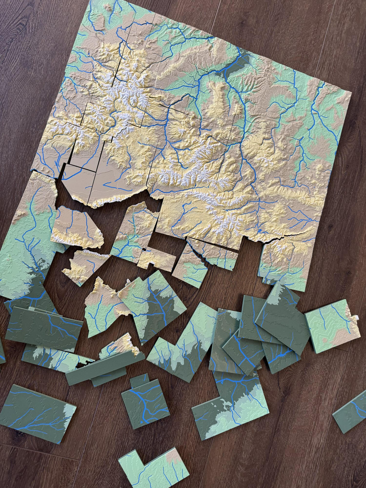
The Colorado puzzle halfway assembled on a wood floor, loose county pieces below it

Colorado, halfway. Start at the four corners; the rivers do the rest.

How a piece is made

Each puzzle starts as the USGS elevation data for the whole state or country, sampled onto a grid and raised into relief. The rivers come from USGS hydrography and Natural Earth, the boundaries from the Census Bureau, all of it public data. The relief is cut along those lines into pieces with a 0.2 mm gap, so they drop in without forcing and sit without wobble.

Each piece is 3D printed in matte PLA on a Bambu Lab H2D, the elevation bands printed in as separate filaments: dark green plains, light green foothills, tan parks and valleys, yellow high country, white summits, cyan water. Nothing is painted. Every piece is on file, so a lost county can be printed again.

None of it is fast. Colorado is eight plates and about 75 hours of printing; the United States is eleven plates and about 70. Each plate is five to twelve hours, and I run them one at a time: load the six filaments, start the plate, and when it comes off, check every piece against the layout, clean the edges by hand, and fit it to its neighbors before it goes in the case. Then the next plate. That is why a set to order takes one to three weeks, and why there is rarely more than one on the shelf.

6 filaments: five elevation bands and water · 0.2 mm clearance between pieces · 70–75 h of printing per set

Your state, by county

Colorado is the first state in the shop. Kansas, Georgia, Ohio, Wisconsin, California, Tennessee, New Mexico, Nebraska and Arizona are already drawn and waiting for someone to ask for them, and any state can be done. Write and tell me which one, and the county you'd pick up first.

A note when a new state is ready.

I send a short email when a new puzzle goes in the shop: a few a year, nothing else.

Range & Township section mark

Range & Township Puzzle Co., LLC · Fort Collins, Colorado · Etsy · [email protected]Terrain: USGS. Boundaries: U.S. Census Bureau. Rivers and lakes: USGS National Hydrography Dataset and Natural Earth. Ages 14 and up; not a toy, contains small parts. © 2026 Range & Township Puzzle Co., LLC.